


I arrived in Huaraz with a simple goal: complete the full four-day Santa Cruz Trek from Cashapampa to Vaquería, record every step, and find out if this classic Cordillera Blanca crossing really deserves its reputation as the Andean multi-day hike for people who do not have time for Huayhuash. What I discovered over four long days, three cold nights, a 4,750 meter pass, and roughly 45 kilometers of trail was a demanding but achievable expedition through some of the most dramatic glacial valleys in Peru, with a very different feel from the longer, more remote Huayhuash circuit.
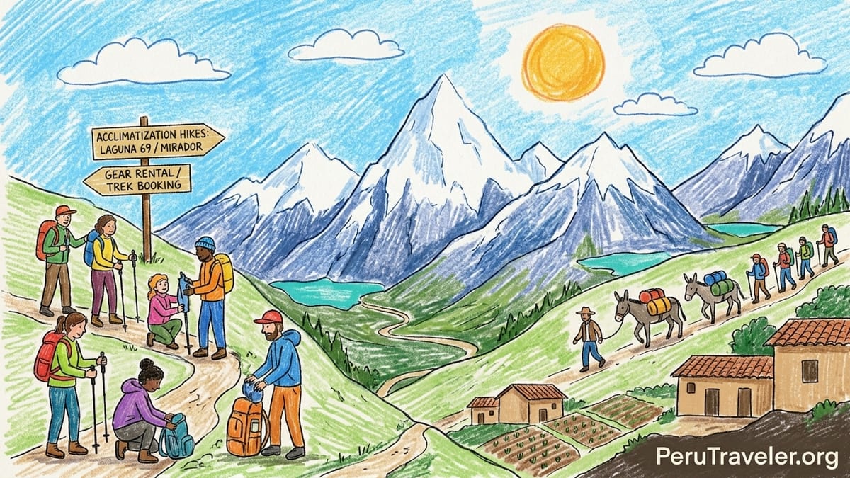
Preparing in Huaraz: Acclimatization, Gear and Booking the Trek
Huaraz is the functional base camp for the Cordillera Blanca, and I quickly learned that arriving just one day before the Santa Cruz Trek is not enough. I checked into a mid-range guesthouse near the Plaza de Armas, paying the equivalent of around 25 to 30 US dollars per night for a private room with hot shower and basic breakfast. From there I spent three full days doing nothing more ambitious than walking around town, climbing the hill to the lookout cross above Huaraz, and letting my body get used to being at roughly 3,050 meters.
On my first full day I walked into several agencies on the main streets around the plaza. Most operators were advertising a four-day, three-night Santa Cruz package that included transport, tents, meals, a local guide, muleteers and pack animals, but not the Huascarán National Park entry fee or any rented gear. Group prices for 2026 departures typically ranged between 220 and 350 US dollars per person for a shared group of six to eight trekkers, with private departures rising steeply for only one or two people. I eventually booked with a Huaraz-based operator offering a confirmed group of eight and a four-day itinerary running Cashapampa to Vaquería, which is the “classic” direction that saves the biggest climb for the pass on day three.
Separately, I paid the Huascarán National Park admission at an office in town and received a paper ticket that was checked at the park control point on the way to the trailhead. Multi-day tariffs are sold in different bands for foreign visitors and Peruvian nationals, with the four-to-thirty-day option priced higher than a single day. The important detail for budget planning is that this fee is independent of the trekking package, and agencies in Huaraz routinely ask you to carry your own ticket or cash to pay it on the first day.
Because I was traveling light, I rented a zero-degree rated sleeping bag and foam mat from a gear shop off the main square. Rental shops in Huaraz carry a mix of brands, from older synthetic bags to newer down models, along with trekking poles, headlamps and down jackets. I inspected zippers and loft carefully and chose a bag that still had decent insulation, paying a daily rate that was modest compared with the overall package. For the trek I carried my own 35-liter daypack with layers, rain jacket, warm hat and gloves, while the agency provided a duffel for anything I wanted the donkeys to carry.
Acclimatization Hikes: Testing Legs Before Santa Cruz
My operator strongly recommended at least one high-altitude day hike before starting Santa Cruz, and in practice most hikers I met in Huaraz had done two. I chose the popular Laguna 69 hike on my second day, which climbs from about 3,900 meters to just over 4,600 meters on a steep but well-trodden trail inside Huascarán National Park. The constant ascending left me out of breath, but I did not develop a headache or nausea, which gave me some confidence for Punta Unión later in the week.
The following day I joined a shorter acclimatization outing to a closer mirador in the Cordillera Negra with a maximum altitude just above 3,800 meters. Compared with Laguna 69, this hike felt gentler, but the views across the valley to Huascarán, Huandoy and the snow line of the Cordillera Blanca helped fix the geography in my mind. Importantly, two days in a row above 3,800 meters let me test gear: I adjusted the length of my trekking poles, noticed that my lightweight gloves were not enough when standing still in the wind, and confirmed that my boots were broken in.
These acclimatization outings also highlighted a key difference with Santa Cruz. On day hikes around Huaraz you return to a warm bed, a hot shower, and restaurant meals. On Santa Cruz you sleep in a tent on cold high-altitude valley floors for three consecutive nights with no showers and limited shelter once the sun drops behind the peaks. By the time I met my group in the agency office for the Santa Cruz briefing, I understood why the staff repeated that being comfortable at altitude was as important as raw fitness.
At the pre-trek briefing the guide ran through the daily plan: a drive from Huaraz to Cashapampa on day one, camping at Llamacorral; a long valley day to Taullipampa on day two; an early start to climb over Punta Unión at roughly 4,750 meters and descend to Huaripampa on day three; and a final steady walk down to Vaquería before driving over Portachuelo Pass and back to Huaraz on day four. The agency estimated daily walking times between six and eight hours, with optional side trips like Laguna Arhuaycocha depending on weather and group energy.
Day One: Cashapampa to Llamacorral, Entering the Santa Cruz Valley
We left Huaraz just after 7 a.m. in a small minibus packed with eight trekkers, the guide, and a cook. The road north followed the Callejón de Huaylas past Carhuaz and Yungay before turning uphill to the village of Cashapampa at around 2,900 meters. At the trailhead a park ranger checked our Huascarán National Park tickets, and we met the muleteer and donkeys that would carry the kitchen, dining tent and our duffels. Temperatures were pleasant in the sun, somewhere in the mid-teens Celsius, and skies were clear with only thin clouds on the highest peaks.
The first meters of the Santa Cruz Trek were a sharp reminder that this is a real ascent, not a flat warm-up. From Cashapampa the path climbs steeply on a rocky, dusty trail that zigzags above the village before squeezing into the narrow lower Santa Cruz valley. For almost the first two hours we gained altitude steadily, and I watched my breathing carefully, settling into a rhythm of short, slow steps. Our guide set a conservative pace, stopping often to let faster hikers walk ahead and then regroup at bends in the trail.
After about three hours we reached the point where the canyon opens and the valley floor widens. Here the trail flattens and follows the Santa Cruz River between steep, rocky walls. We paused for lunch near the water, where the cook produced soup, rice and vegetables from his donkey-carried kitchen. My GPS watch recorded roughly 9 to 10 kilometers by this point with an elevation gain of about 800 meters, which matched the guide’s expectation for a six-hour first day.
By mid-afternoon we reached Llamacorral, a broad, grassy bench around 3,750 meters with simple stone walls marking camping areas. Several other groups had pitched tents there, and by dusk there were at least 20 brightly colored tents scattered along the valley side. The commercial camping setup was functional rather than charming: our operator supplied two-person tents, a larger dining tent with folding tables and stools, and a small toilet tent set up away from the main camp. Night temperatures dropped rapidly once the sun disappeared behind the ridge, falling below freezing by 8 p.m. I slept in thermal base layers, fleece, hat and socks inside my rented sleeping bag and still woke a few times from the cold, but overall managed a reasonable first night’s sleep at altitude.
Day Two: Llamacorral to Taullipampa, Lakes and an Optional Detour
The second day began with frost on the tents and a thin layer of ice on water buckets, but a clear cobalt sky. After hot tea delivered to the tent and a simple breakfast of porridge, eggs and bread, we started walking around 8 a.m. From Llamacorral the trail continues up the wide Santa Cruz valley, and this section is arguably one of the most photogenic days of the trek. Within an hour we reached the first of the two main lakes, Ichiccocha, whose greenish water mirrored snow peaks at the head of the valley. Another gentle hour brought us to the larger Jatuncocha, a long turquoise lake flanked by swampy meadows where horses and donkeys grazed.
The walking on this day was a mix of flat and gentle undulations rather than steep climbs, but the altitude made every small rise noticeable. Our guide kept the group moving steadily to avoid cooling down in the sharp morning wind. We covered around 12 to 13 kilometers over the course of the day, according to my watch, with overall elevation gain of roughly 500 meters as we approached the base of Taulliraju. The valley narrowed again near the head, and we began to see the iconic pyramidal shape of Artesonraju, often cited as the inspiration for the film studio logo, looming to the right when the clouds parted.
Above Jatuncocha the trail splits, with one option following the main valley to Taullipampa and the other climbing more steeply toward the side valley of Arhuaycocha and its glacial lake. Our original plan had been to take the detour to Laguna Arhuaycocha as a day hike from camp, but by the time we reached the junction high clouds were thickening, and the guide worried about afternoon storms building up. Instead, he suggested that only those feeling strong and moving quickly could attempt the side trip, while the rest would continue at a relaxed pace toward camp.
I opted to walk directly to Taullipampa, accepting that I would trade the view of the famous Alpamayo fluted face for fresher legs on the pass day. By early afternoon we arrived at Taullipampa, a wide, grassy plain at around 4,250 meters, hemmed in by moraines and vertical rock walls, with Taulliraju towering directly above to the east. Several agencies use this camp, and I counted more than a dozen tents scattered around the plain. Despite the crowding, the setting felt spectacular rather than busy, because the valley is so broad that groups can spread out.
As the afternoon wore on, cloud built around the high ridges and a light snow began to fall. Our guide used the dining tent as a briefing room, explaining that we would start before sunrise the next day to cross Punta Unión before midday when weather is usually more stable. The snowfall intensified around dinner time, tapping on the tent fly as we ate quinoa soup and stewed chicken. Overnight the temperature plunged well below freezing, cold enough for the condensation inside the tent to turn to ice. My rented bag kept me just warm enough, but I regretted not packing a slightly thicker sleeping mat to insulate from the ground.
Day Three: Crossing Punta Unión to Huaripampa, The Hardest Day
We woke at 4:30 a.m. to a world transformed. A thin layer of snow dusted the grass around camp, headlamps flickered like fireflies across the plain, and the sky was still clear above a horizon line of dark peaks. After a quick breakfast we left Taullipampa around 5:30 a.m., wearing all our layers. The first part of the climb to Punta Unión followed a gentle slope above the eastern end of the valley, but the altitude at 4,300 meters made even this section feel like work.
As the trail steepened, the valley floor dropped away behind us and the snow underfoot turned to patches of hard ice in shaded gullies. The path wound between boulders and up short rocky ledges, but never required hands-on scrambling. Our guide kept us moving in single file, calling for brief pauses every 20 to 30 minutes. I watched my heart rate spike higher than on any previous day, and my breathing became a measured two steps per inhale, two steps per exhale. This sustained climb from Taullipampa to Punta Unión took our group about three hours, with an elevation gain of roughly 500 meters to the pass at around 4,750 meters.
The final approach to Punta Unión is one of the most memorable segments of the entire trek. The path climbs toward a rock wall that looks almost continuous until, suddenly, a narrow notch opens and you see the other side. Stepping through that notch onto the flat rocks of the pass felt like crossing from one world to another. Behind us stretched the full length of the Santa Cruz valley, with Taullipampa a tiny patch of green and the white faces of Taulliraju rising above. In front of us the Huaripampa valley dropped away steeply, and a jagged skyline unfolded, including views toward the glaciated summits above the Quitaracsa and Huaripampa valleys. When clouds shifted, we caught framed glimpses of Artesonraju’s steep summit pyramid and other unnamed icy peaks.
Wind on the pass was bitter, and despite the exhilaration most of us could only stand still for a few minutes before fingers went numb. The guide took quick photos for everyone, pointed out the main peaks, and reminded us that the day’s effort was only half finished. For many in our group, including me, the psychological difficulty of the climb was as significant as the physical one. The sustained ascent at high altitude, on the back of two long days of walking and two cold nights of sleep, made this feel harder than any of my acclimatization hikes from Huaraz, even though the vertical gain was similar to Laguna 69.
The descent toward Huaripampa turned out to be surprisingly tough on tired knees. The trail drops on rocky, sometimes loose switchbacks to a hanging valley dotted with small turquoise tarns, then descends more gradually through open alpine meadows. By late morning clouds thickened, and the snowfall that had dusted Taullipampa the night before returned as light sleet. Our guide monitored the group carefully, slowing the pace to keep everyone together. Because of the weather we skipped the idea of an extended lunch stop, instead eating quickly behind a boulder before continuing downhill.
We reached the Huaripampa camping area in mid-afternoon after what my watch recorded as roughly 15 kilometers of walking for the day. The campsite, at around 3,800 meters, lies on a broad grassy shelf above the valley floor. Here the landscape felt more inhabited: local families grazed cattle and horses, and children occasionally approached to sell snacks or simply say hello. Several commercial trekking groups shared the same flat ground, but tents were spaced out and the atmosphere felt more relaxed than the confined bowl of Taullipampa. Nighttime temperatures were still freezing, but noticeably less brutal than the second night, and I slept more soundly despite sore legs.
Day Four: Huaripampa to Vaquería and the Long Road Back to Huaraz
The last walking day began with clear skies and a strong sense of completion. From Huaripampa the trail follows the valley downstream, passing through a patchwork of fields, stone walls and adobe houses. After three days in high, largely uninhabited valleys, walking past schoolchildren in uniforms and farmers leading donkeys felt almost surreal. This section of the route is gentler underfoot, with more packed earth and fewer big boulders, but the accumulated fatigue meant that even small hills were still noticeable.
We covered around 10 to 11 kilometers from camp to Vaquería, much of it on a combination of footpaths and dirt road. The valley gradually narrows again, and by late morning we climbed a final short hill to reach the roadhead where our minibus was waiting. Here the agency staff paid the muleteer, we said goodbye to the donkeys, and everyone changed from trekking boots into sandals or sneakers. The weather held sunny and dry for the entire morning, underlining how much luck plays into the experience of Santa Cruz. Our guide mentioned previous groups who had faced heavy afternoon rain on this section or low cloud obscuring the big valley views earlier in the trek.
The adventure was not entirely over, though. From Vaquería the return to Huaraz involves a spectacular, narrow dirt road that climbs to Portachuelo de Llanganuco, a vehicle pass above 4,600 meters with hairpin turns that look straight down onto the turquoise Llanganuco Lakes far below. The drive took around three hours including a brief stop at the lakes for photos. By the time we rolled back into Huaraz around early evening, my watch showed around 45 kilometers of total walking over the four days, excluding minor side wanders around camp.
Back in town, the contrast with trekking life was immediate. I checked into the same guesthouse, took a very long hot shower, and stepped out to a restaurant where I ordered the heaviest, saltiest meal I could find. Only after sleeping in a real bed did I fully register how much the cold nights, combined with thin air and constant movement, had taxed my body.
Weather, Crowds, Difficulty and Group Dynamics
My four days on Santa Cruz fell in the dry season window, when operators in Huaraz schedule the bulk of their departures because skies are usually clearer and trails more stable. Even in this ostensibly stable period we encountered light snow at Taullipampa, sleet on the Punta Unión descent, and freezing temperatures all three nights. Average daytime temperatures at these altitudes are often in the low to mid teens Celsius in the sun, but windchill and cloud can make it feel close to freezing. Nighttime lows at Taullipampa routinely drop below zero and can approach minus 5 to minus 10 degrees Celsius in cold snaps, which matched the frost and ice we saw around camp.
Crowding is another reality of Santa Cruz. It is the best-known multi-day trek in the Cordillera Blanca, and agencies in Huaraz funnel many hikers onto the same limited campsites. At Llamacorral and Taullipampa we shared space with multiple commercial groups, identifiable by their matching tents and dining setups. The atmosphere was generally friendly, and there was enough room to find some privacy, but this is not a wilderness experience in the sense of solitary camps. In contrast, Huaripampa felt more spread out, with trekkers dispersed among local fields and small house clusters.
In terms of difficulty, I found that the advertised “moderate to challenging” rating was broadly accurate. No single day involved technical terrain, but the combination of altitude, sustained distances of 10 to 15 kilometers per day, and three cold nights in a row adds up. For me, day three over Punta Unión was clearly the hardest, not only because of the climb but because it landed after two already demanding days. Hikers who come directly from sea level without acclimatization would almost certainly struggle more. Among our group, those who had not done a high day hike like Laguna 69 beforehand reported more headaches and shortness of breath.
Group dynamics and pace significantly colored my experience. Our guide consciously kept a steady, moderate pace that allowed slower members to stay within sight. This meant that the fittest hikers sometimes felt impatient, particularly when stopping every half hour on the climb to Punta Unión. At the same time, that inclusive pace likely prevented any serious altitude issues. Conversations in camp with trekkers from other groups revealed a range of approaches: some agencies push for fast start times and longer days to fit in side trips like Laguna Arhuaycocha, while others prefer conservative itineraries that prioritize safety over squeezing every possible viewpoint into the schedule.
Packing Lessons, Costs and Whether I Would Do It Again
Four days on the Santa Cruz Trek taught me as much about what I should have packed as what I brought. My layering system of base layer, fleece and shell worked well for walking, but I underestimated how cold evenings in camp would feel. If I repeated the trek I would add a light down jacket for use around camp and inside the sleeping bag, plus a thicker sleeping mat to insulate from the frozen ground. I was grateful for two pairs of gloves: a thin liner pair for walking and a thicker, insulated pair for the pass and camp. A buff or neck gaiter proved invaluable in cold wind and strong sun alike.
On the small-items side, a headlamp with fresh batteries, extra socks, sunscreen and lip balm with high SPF, and a small power bank for charging a phone or camera all proved useful. I regretted not bringing earplugs; in group camps the sounds of donkeys, early risers and tent zippers start well before dawn. For snacks, I carried high-energy items like nuts, chocolate and simple Peruvian cookies bought in Huaraz supermarkets, which supplemented the agency meals and helped on long climbs.
From a cost perspective, the main expenses for Santa Cruz were the guided package, Huascarán National Park entry, gear rental, accommodation and meals in Huaraz before and after, and transport to and from town. Booking locally allowed me to compare several agencies in person and choose a departure with enough confirmed participants to keep the price reasonable. Keeping the park admission separate from the operator’s fee had one advantage: the ticket remained valid for additional visits within the same multi-day band, making it easier to justify another hike like Laguna 69 on a different day.
The final question is whether I would repeat the four-day version or opt for a slower five-day itinerary if I returned. For hikers already acclimatized and comfortable with 6 to 8 hours of walking per day, the four-day crossing feels satisfying and efficient. However, a five-day version that includes more time at Taullipampa, a guaranteed side trip to Laguna Arhuaycocha, or a shorter day after Punta Unión could make the experience less rushed and allow for longer photo stops and rest periods. Personally, if I came back to Santa Cruz I would likely choose a five-day route to savor the scenery more and reduce the pressure on the hardest day.
As for guided support, I left convinced that the cost was justified. The logistics of donkeys, food, gas, and safe campsites at high altitude are non-trivial, and having a local guide who knew alternative routes, weather patterns and how to respond to altitude issues made the trek feel safer and more enjoyable. Independent trekkers certainly walk Santa Cruz carrying all their own gear, but for my first serious multi-day Andean hike in the Cordillera Blanca, the combination of guide, cook and muleteer struck a good balance between challenge and support.
The Takeaway
Santa Cruz is not a consolation prize for people who cannot fit Huayhuash into their schedule. Over four focused days, this trek delivers a condensed version of what makes the Peruvian Andes special: glacial valleys lined with turquoise lakes, serrated snow peaks rising abruptly from green meadows, and a tangible sense of crossing from one side of a great mountain range to the other. It demands real effort at altitude, but it does not require technical climbing or extreme expedition logistics.
My experience, walking from Cashapampa to Vaquería, suggested that the four-day Santa Cruz Trek suits hikers who already have some trekking experience, are willing to acclimatize in Huaraz with at least one or two day hikes, and can accept cold, basic camping. Weather will always be a factor, and bad conditions can easily cancel side trips or obscure the highest peaks, but even with snowfall on Punta Unión the underlying drama of the landscape remained obvious.
Compared with the acclimatization hikes I did beforehand, Santa Cruz felt longer, harsher and more immersive, but also more rewarding. The repeated pattern of dawn frost, long valley days, and evenings watching alpenglow on distant summits created a rhythm that short day hikes cannot replicate. Most importantly, the moment of stepping through the notch at Punta Unión and seeing the Cordillera Blanca spill away in both directions justified every breathless step.
If your time in the Peruvian Andes is limited and you want a multi-day trek that feels like a genuine expedition without committing to ten or twelve days, the Santa Cruz Trek deserves serious consideration. Arrive in Huaraz ready to acclimatize, choose an operator that matches your comfort and budget, and pack for cold nights. The reward is four days in a landscape that will stay with you long after you have driven back down to the valley.
FAQ
Q1. How many days do you really need for the Santa Cruz Trek?
Four days is the standard guided itinerary between Cashapampa and Vaquería, but a five-day version gives more time for side trips and easier daily distances.
Q2. Which direction is better, Cashapampa to Vaquería or the reverse?
Walking from Cashapampa to Vaquería saves the highest climb for the third day at Punta Unión, while starting in Vaquería tackles the pass earlier but front-loads the altitude.
Q3. How hard is the Santa Cruz Trek compared with Laguna 69?
Laguna 69 is a steep day hike at similar altitude, but Santa Cruz adds consecutive long days, camping and a 4,750 meter pass, so overall it feels more demanding.
Q4. Do you need a guide for the Santa Cruz Trek?
The trail is generally clear and some experienced hikers go independently, but a guided trek simplifies logistics, improves safety and supports local muleteers and cooks.
Q5. What are typical temperatures on the trek?
During the dry season, daytime temperatures in the sun can feel mild, while nights at camps like Taullipampa often drop below freezing and can be very cold.
Q6. Is it possible to do Santa Cruz without donkeys carrying your gear?
Yes, you can carry all your equipment in a backpack, but the altitude and distances make this significantly tougher than joining a supported trek with pack animals.
Q7. How much acclimatization time in Huaraz is recommended before starting?
Spending at least two or three nights in Huaraz and doing one or two day hikes above 3,800 meters greatly reduces the risk of altitude problems on Santa Cruz.
Q8. Are there bathrooms or showers at the campsites?
Campsites usually have simple pit toilets or agency toilet tents, but there are no showers, and washing is limited to a basin of cold or warm water.
Q9. What extra gear do people most often wish they had brought?
Many trekkers wish for a warmer sleeping setup, including a better sleeping mat, a down jacket for camp, spare gloves and small comforts like earplugs and extra snacks.
Q10. Would you recommend the four-day or five-day version for most hikers?
Fit, well-acclimatized hikers are fine with four days, but many people would enjoy the scenery more and feel less rushed with a slightly slower five-day itinerary.