


When I first penciled Pastoruri Glacier into my Huaraz itinerary, I imagined crunching over bright white snow, walking between blue crevasses and posing with an ice axe at more than 5,000 meters. Older guidebooks and agency posters still sell that fantasy. The reality in 2026 is very different: Pastoruri is now a lesson in climate change as much as it is a high-Andes day trip. After joining an authorized tour from Huaraz and spending a full day on the Climate Change Route, I came back with mixed feelings about the long drive, the thin air and the shrinking glacier. Here is what I actually experienced, and whether I think Pastoruri is still worth your time and money.
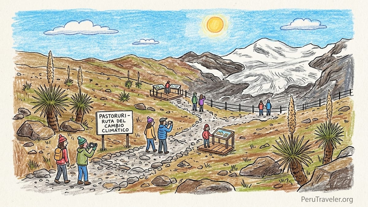
Imagining Pastoruri: Expectations Built on Old Images
In Huaraz, Pastoruri appears everywhere. Agency windows around the Plaza de Armas are plastered with glossy photos of skiers on a wide white glacier, kids playing in fresh snow and tourists standing beside sculpted ice towers. Several posters still show people walking directly on the glacier surface, images that date from before authorities restricted access because of rapid retreat and safety concerns. When I booked my tour, the agency’s printed brochure looked similar: bright snowfields, a broad tongue of ice sweeping down toward a small lagoon, and not a single bare rock in sight.
Those visuals primed my expectations. I pictured something like a mini-Alps experience, but in the tropics: a short walk from a high road to a glacier where I might still step on snow, even if only briefly. I had read that Pastoruri sits in the southern part of Huascarán National Park, within the Cordillera Blanca, one of the world’s highest tropical mountain ranges, and that the glacier itself reaches more than 5,200 meters at its highest sections. I imagined cool, clean air, some effort because of the elevation, but nothing too punishing. After all, agencies in town promote Pastoruri as one of the “easier” high-altitude outings compared with steep treks like Laguna 69.
There were hints that this vision was outdated. A few agencies now market Pastoruri explicitly as the “Ruta del Cambio Climático,” or Climate Change Route, emphasizing glacier retreat and environmental education. One operator told me bluntly that “the glacier is much smaller now” and that you no longer walk on the ice itself. Still, tour photos on their tablet slid back to those classic scenes of visitors standing on white snow. That tension between marketing and modern reality became the central theme of my day.
Booking a Legal Tour from Huaraz: Times, Prices and What Was Included
To reach Pastoruri, independent visitors must pass through Huascarán National Park checkpoints, so the simplest and most common option is to join an authorized day tour. In October 2026, agencies around central Huaraz were advertising Pastoruri between 60 and 90 soles per person for a shared bus or minivan, including transport and a Spanish-speaking guide. Some online platforms showed small-group tours from about 30 US dollars without park fees. On the ground, after comparing several counters, I settled on a local agency charging 70 soles in cash, with the understanding that the Huascarán National Park entry fee was not included.
The agency promised hotel pickup between 8:00 and 8:30 a.m., a guide certified to operate in the park, and a return to Huaraz around 6:00 or 6:30 p.m. The staff emphasized that the vehicle would be “cómodo,” comfortable, and repeatedly described Pastoruri as a good acclimatization outing because the walking distance from the parking area is relatively short. They also said we would make several scenic stops on the Climate Change Route. However, the list of exact stops varied from agency to agency, and no one would guarantee specific wildlife sightings or blooming Puya raimondii plants, only that “you will see the plants in the landscape.”
Pickup the next morning was fairly punctual. At 8:20 a.m. a mid-size tourist bus pulled up in front of my guesthouse in Huaraz. Seats were standard intercity-bus style with limited legroom but reclining backs. There was no onboard toilet, which matters on a route that can involve more than seven hours of driving round-trip. Our guide introduced himself over the bus speakers, checked a printed list of names and collected park-fee cash from those who wanted to pay in advance. Others chose to pay directly at the checkpoint, which is still cash-only in soles, according to staff in the park sector office.
The Long Road South: Towns, Road Conditions and Real Stops
Leaving Huaraz around 9:00 a.m., we headed south along the Callejón de Huaylas valley toward the town of Recuay. The first hour is on the main paved highway, and the ride was smooth enough, with only the usual Andean curves. We passed semi-industrial outskirts, small brick settlements and then more rural scenery. The guide pointed out Recuay and nearby San Patricio, where some tours sometimes stop at a small grotto. Our bus did not. One of the first lessons of the day was that each Pastoruri tour follows a similar framework, but not every advertised mini-attraction is included in every departure.
Beyond Ticapampa and Cátac, we turned off onto the road toward the Pastoruri sector of Huascarán National Park. The surface remained paved but more patched and potholed. The bus slowed on certain stretches to avoid deep ruts. Although the distance from Huaraz to the Pastoruri parking zone is often quoted at around 80 kilometers, the combination of curves, altitude gain and photo stops makes the journey feel longer than the numbers suggest. By the time we reached the park control post about 1.5 to 2 hours after leaving Huaraz, several passengers were already starting to feel mild headaches from the elevation.
At the Huascarán National Park checkpoint, we got off the bus to pay the conservation fee. In 2026, the day-visit tariff for national parks in Peru is usually listed per person in soles, with different rates for Peruvians and foreign visitors. Our guide explained that Pastoruri falls under the Huascarán scheme and reminded everyone that credit cards would not be accepted here. After showing IDs and receipts, we reboarded and continued along what is officially promoted by park authorities as part of the Climate Change Route, a circuit designed to show the effects of warming on the high-Andes environment.
Along the Climate Change Route: Patococha, Pumapashimin and Puya Raimondii
The paved road winds through open puna landscapes and shallow wetlands, with the Cordillera Blanca peaks appearing and disappearing between ridges. Our first official photo stop was at Patococha, a small lake fringed by ichu grass and cushion plants. Some tours highlight its birdlife, especially during certain times of year, but in mid-October our group only saw a few distant waterfowl. The guide used the moment to talk about how wetlands in this zone rely on glacial meltwater and seasonal rains, and how shifts in glacier volume are changing flow patterns over time. It was more of a roadside pause than an in-depth nature stop, and we were back on the bus after about 10 minutes.
Farther along, we reached an area of naturally carbonated springs sometimes called Pumapampa. Clear water bubbled through mineral-rich ground, forming small pools that effervesced like soda. Wooden walkways limited where we could step in order to protect the fragile surface. The guide let us taste a little of the water and pointed out the iron-rich reddish deposits staining nearby rocks. This was one of the more engaging stops, because it highlighted the unusual chemistry of high-Andes groundwater and gave context to why the Climate Change Route does not focus solely on the ice.
Close by, we walked a short distance to Pumapashimin, also spelled Pumapashimi or Pumashimin, often described as a “seven-color lagoon.” On sunny days, minerals in the shallow pool can give the water shifting hues of turquoise, milky white and pale green. On our visit, intermittent cloud cover muted the colors, but the contrast with the surrounding yellow-brown puna was still striking. Panels near the lagoon referenced how changes in water input from retreating ice can alter lagoon levels and chemistry, though the explanations were more general than technical.
Continuing up the valley, the landscape opened to a hillside scattered with Puya raimondii, the giant bromeliad that has become a signature of this sector of Huascarán National Park. Our driver pulled over and we got out to follow a short path leading closer to several mature plants. Their huge spiky rosettes and towering, dried flower stalks were impressive, each an architectural column rising above the slopes. The guide explained that these plants can take many decades to bloom and then die after sending up a single giant inflorescence, making their life cycle especially sensitive to climatic shifts. Some visitors hoped to see one in full green bloom, but at this time of year we mainly saw old flower spikes and younger vegetative rosettes. Again, conditions are never guaranteed, and tours cannot promise peak flowering on a given day.
Reaching Pastoruri: Altitude, Path and What You Actually See
From the Puya raimondii zone, the final drive to the Pastoruri parking area took about 20 to 25 minutes on a narrower, rougher road. The bus jolted frequently as we climbed above 4,800 meters. At the parking lot, our guide announced that we were at roughly 4,900 to 5,000 meters above sea level, depending on which GPS or signboard you consult. Nevado Pastoruri itself, the peak and glacier mass above us, rises higher, with sources describing maximum elevations above 5,200 meters. Tourists, however, do not reach the summit or upper glacier. The highest viewpoints on the Climate Change Route are slightly above 5,000 meters, below the active ice.
From the parking zone, a stone and gravel path climbs toward the glacier viewpoint. Authorities have designed this route as a gradual ascent of about 1.5 kilometers, and many agencies advertise it as a 40-minute to 1-hour walk each way. That distance might sound easy on paper, but at this extreme altitude the effort is real. Within the first 10 minutes, I felt my breathing quicken noticeably. The air was thin, the wind carried a sharp chill and conversations became broken into short phrases between breaths. Several older travelers and a family with children stopped frequently to rest on stone benches along the way.
The trail is not technically difficult. It follows a broad path that was once more like a vehicle track, and it is well defined and non-exposed. There are basic emergency posts and occasional signs reminding visitors to walk slowly and drink water. Simple toilet facilities are located near the parking area, not at the highest viewpoint, so anyone who needs them must plan before starting the walk. There are also a few local vendors renting horses for part of the ascent, though regulations about exactly where they can operate have tightened over time to reduce erosion.
Despite the relatively short distance, the combination of altitude, wind and cold meant that most of our group took close to 45 minutes to reach the upper viewpoint, some longer. Gloves, a warm hat and windproof layers were essential. A couple of people who had arrived in Huaraz only the day before struggled noticeably and chose to stop at a lower viewpoint instead of continuing to the highest platform. The experience underscored a key point: a “short walk” at 5,000 meters is not comparable to the same distance at sea level. Even for fit hikers, the lack of oxygen makes every step slower.
The Shrinking Glacier: Climate Change Route Versus Old Marketing
At the top of the path, I finally faced Pastoruri. Compared with the sweeping white slopes in decades-old photos, the glacier that remains in 2026 feels more like a fractured, retreating icefield clinging to the upper ridge. The lower tongue that once reached almost to the trail has pulled back significantly, leaving behind a basin of dark rocks, small tarns and streaks of dirty residual ice. Interpretive panels along the Climate Change Route show images from past decades, where the glacier extended far lower, and mark approximate former ice limits. Seeing those side by side with the current scene was sobering.
Visitors are not allowed to walk onto the glacier itself. Ropes, fences and clear signs keep the public on designated viewpoints, several dozen meters away from the unstable ice front. Park authorities emphasize that the glacier margin is prone to sudden collapses, hidden crevasses and icefalls, especially as melt accelerates. Even if regulations permitted closer access, it would not be wise to approach the vertical seracs without full mountaineering gear and expert guidance. What you see today is a glacier in retreat, with exposed rock areas growing each year, rather than an intact plateau for recreational walking.
From the viewpoint, the educational aspect of the Climate Change Route came into focus. Panels reference how Pastoruri, like many tropical glaciers worldwide, has lost a significant portion of its volume over recent decades, linked to rising temperatures and changes in precipitation patterns. Scientific reports compiled in recent years describe how tropical glaciers respond quickly to climatic shifts, because they are relatively small and situated in narrow elevation bands. Pastoruri has been used in environmental communication campaigns precisely because its retreat is so visually obvious when you compare older and newer photographs.
Yet, on the ground, not everyone absorbed the message. Around me, some visitors posed with the glacier in the background for a quick photo and then checked their phones, perhaps frustrated by limited signal. A few expressed disappointment in Spanish that “there is not much snow anymore,” echoing the gap between their expectation of a huge icy expanse and the reduced glacier now visible. The marketing materials they had seen in Huaraz had not fully prepared them for the reality of a shrinking gray-and-white iceface tucked above bare rock.
Time on the Mountain Versus Time in the Bus
Our guide gave us about one hour and fifteen minutes of free time at Pastoruri, including both ascent and descent. For me, that translated into roughly 45 minutes to climb and absorb the upper viewpoint, and around 30 minutes to walk back down. Those who reached only the mid-way viewpoint still had some minutes to sit and contemplate the scene before turning around. In practice, however, time at the actual glacier viewpoint felt short compared with the long journey to get there. Counting our brief roadside stops, we spent about four hours driving from Huaraz to Pastoruri and around three hours returning, including a late lunch stop in Ticapampa.
That ratio of bus time to glacier time is worth considering. Out of an approximately 10-hour day, no more than one and a half hours were spent in direct view of Pastoruri’s ice. Another hour to hour and a half covered interpretive stops like the carbonated springs, Pumapashimin and Puya raimondii, depending on how quickly the group reboarded at each place. The rest of the day took place behind bus windows, watching farmland, wetlands and mountains roll by. For travelers who dislike long bus journeys or who are very sensitive to road curves, this can feel like a small dose of glacier for a big investment of sitting still.
From a practical standpoint, our bus was reasonably comfortable and the driver careful. The road was fully paved but with enough potholes on the later stretch to make standing or moving around unsafe. There were no formal emergency medical staff at the glacier itself beyond basic park personnel and the guide’s first-aid kit. In case of serious altitude sickness, the real solution would be to descend again to a lower town as quickly and safely as possible. Our guide monitored the group but openly reminded everyone that they were responsible for recognizing their limits.
Costs, Extras and How Pastoruri Compares to Other Huascarán Highlights
By the end of the day, my total spending on Pastoruri was straightforward to tally. The 70 soles tour fee covered pickup, transport and guiding. The Huascarán National Park entry fee added another separate amount in soles at the control gate, paid in cash. Lunch was not included; we stopped at a basic restaurant in Ticapampa on the way back, where a set menu of soup and a main dish cost roughly the price of a simple Andean meal. Optional extras included hot drinks at small roadside stands and, for those who chose them, partial horse rides along the trail, negotiated directly with local handlers for an additional charge. Overall, Pastoruri came out cheaper than more logistically complex treks but more expensive than simply taking public transport to lower-elevation viewpoints.
In terms of experience, I found Pastoruri very different from popular day hikes like Laguna 69 or Laguna Churup. Those involve several hours of sustained uphill walking, with strong physical exertion spread across the day, and reward hikers with brilliant turquoise lakes backed by near-vertical ice walls. Pastoruri, in contrast, concentrates the effort into a single, high-altitude push of less than an hour and offers a more muted, though still powerful, visual of a receding glacier. It felt more like an environmental field trip than a classic scenic hike.
Laguna 69, which I had visited earlier in the week, delivered relentless beauty for much of the trail: waterfalls, side valleys and a spectacular final amphitheater of peaks. The tradeoff was a very early departure, a long walking day and a packed trail in peak season. Pastoruri’s route felt quieter, with more varied stops on the way, but the final scene was one of loss rather than abundance. Laguna Churup, closer to Huaraz and involving a shorter but steep ascent with some simple scrambling, offered a middle ground in both distance and altitude. Compared with both of those, Pastoruri demanded more respect for extreme elevation despite the short path and confronted me more directly with climate realities.
Whether Pastoruri “beats” any of these other attractions depends on what you seek. If you want a full-day hike in lush valleys leading to a postcard lake, Laguna 69 remains the standout. If you prefer a half-day with a bit of adventure close to town, Laguna Churup is compelling. If you are specifically interested in glaciers, climate change and the story of tropical ice, Pastoruri occupies a unique niche in the region that the lakes do not fully replicate.
What I Imagined, What Disappointed Me and What I Learned
Going into the trip, I imagined wide snowfields and the possibility of stepping, however briefly, onto a glacier surface at the heart of the Cordillera Blanca. That fantasy had been nourished by older articles, tour posters and even some recent online images that recycled decades-old photos. Part of me knew the reality must have changed, yet I still hoped for a stronger feeling of being “on the ice” rather than merely looking at it from a distance.
The main disappointment was not the size of the glacier itself. I had read enough about rapid tropical glacier retreat to expect a diminished ice body. What surprised me was the relatively constrained viewing area and the sense of separation from the ice, imposed by necessary but strict safety boundaries. Rationally, I understood why authorities prohibit approaching unstable seracs, where collapses could be fatal. Emotionally, I felt removed, watching a powerful scene play out behind an invisible barrier. For travelers who still imagine skiing slopes or playing in snow at Pastoruri, the dissonance will likely be even sharper.
Yet the visit was undeniably educational. Walking along panels that documented the glacier’s former extent, hearing the guide describe how local communities and park staff now use Pastoruri as an open-air classroom, and feeling the effects of altitude so intensely all combined into a vivid lesson. Glacier retreat was no longer an abstract figure in a report; it was a visible scar on the mountain. The Climate Change Route might not deliver spectacular ice formations at close range, but it does deliver context. For environmentally minded travelers, that context can be as valuable as a traditional “wow” view.
By the time we rolled back into Huaraz around 6:30 p.m., with the lights of the city flickering on below the dark silhouettes of the Cordillera Negra, I concluded that Pastoruri sits at an important crossroads between tourism and climate reality. It is accessible enough to welcome visitors who are not hardcore trekkers, yet altered enough by warming temperatures that it forces us to confront what has been lost and what may still be saved elsewhere.
The Takeaway: Who Should Go and Would I Pay Again?
Looking back, my experience of Pastoruri fell into several clear stages: what I imagined, the journey, what remained of the glacier, how the altitude affected me, what disappointed me and what I learned. I had pictured stepping onto broad snowfields under a flawless Andean sky. Instead, I spent hours in a bus, walked a short but demanding path in thin, cold air and looked from a respectful distance at a glacier that has retreated markedly from the images that once drew tourists here.
The journey itself, through the southern part of Huascarán National Park, was not wasted. Patococha’s quiet waters, the bubbling carbonated springs of Pumapampa, the subtle colors of Pumapashimin and the stark silhouettes of Puya raimondii created a mosaic of high-Andes environments that I would not have seen from Huaraz alone. Wildlife sightings were modest and plant flowering was not at its peak, which underscored an important truth that no agency can guarantee birds, colors or blooms on a given day. Nature has its own schedule, and the Climate Change Route is not a theme park.
The altitude was the most intense physical factor. Even with several days in Huaraz beforehand, the walk to the Pastoruri viewpoint at over 5,000 meters pushed my breathing and heart rate far harder than the distance would suggest. The path is short and non-technical, but that does not mean it is easy. For some travelers, especially those with cardiovascular or respiratory issues, or those arriving directly from sea level, the altitude can turn an advertised “light walk” into a serious challenge.
Would I pay again? For myself, probably not, at least not as a repeat day tour. The educational impact of seeing Pastoruri once was strong and worthwhile, but the limited time near the glacier and the long hours in the bus make it a one-time experience for many visitors. However, I do not regret going. If you are interested in climate change, tropical glaciers and the complex ethics of visiting a vanishing landscape, Pastoruri can be a powerful, if sobering, day.
For families, Pastoruri is suitable only if everyone is well-acclimatized and comfortable with the idea that a short walk at extreme altitude can still feel hard. Children who are used to hiking and have spent several nights in Huaraz may manage fine, but parents should be prepared to turn back early if anyone struggles. For environmental travelers, the Climate Change Route offers rare, direct exposure to the story of a retreating tropical glacier within a UNESCO-listed national park. Photographers will find dramatic skies, interesting high-puna textures and a compelling juxtaposition of ice and bare rock, though not the vast, pristine glacier panoramas still shown on outdated posters.
For visitors who want mountain scenery without a long trek, Pastoruri can be appealing, but expectations must be set carefully. You will spend more time in the vehicle than on the trail, and what you see at the end is not a classic glacier fantasy but a changing landscape that raises questions about tourism’s role in an era of rapid warming. If you can accept that, and if you are prepared for thin air, wind and cold, Pastoruri is still worth a visit, not as a playground on ice, but as a candid, sometimes uncomfortable conversation with a glacier on the edge.
FAQ
Q1. Can you still walk on Pastoruri Glacier?
Today visitors are not allowed to walk on the glacier itself. Park regulations keep tourists on designated viewpoints a safe distance from the unstable ice margin.
Q2. How high do you actually go on a Pastoruri tour?
The parking area is around 4,900 to 5,000 meters, and the highest viewpoint on the Climate Change Route is slightly above 5,000 meters, below the upper glacier and peak.
Q3. How long is the walk from the parking lot to the glacier viewpoint?
The stone path from the parking zone to the main viewpoint is roughly 1.5 kilometers each way, usually taking 40 minutes to 1 hour uphill at high altitude.
Q4. How much does a Pastoruri tour from Huaraz cost in 2026?
Shared day tours from Huaraz typically run around 60 to 90 soles per person for transport and guide, with the Huascarán National Park entry fee paid separately in cash.
Q5. What are the road conditions like from Huaraz to Pastoruri?
The route is fully paved but has curves and potholes on the higher stretch. Expect about four hours of driving to reach Pastoruri with short scenic stops on the way.
Q6. Do all tours stop at Patococha, Pumapashimin and the carbonated springs?
Most tours include several of these Climate Change Route stops, but exact itineraries vary. Not every departure visits every site or spends the same amount of time at each.
Q7. Is Pastoruri suitable for children or older travelers?
Pastoruri can be suitable for acclimatized families and older travelers, but the altitude makes the short walk demanding. Anyone with health issues should consult a doctor and be ready to turn back early.
Q8. What should I wear and bring for a Pastoruri day trip?
Warm layers, a windproof jacket, gloves, hat, sun protection, water and some snacks are essential. There is no shelter at the upper viewpoint, and weather can change quickly.
Q9. How does Pastoruri compare with Laguna 69 and Laguna Churup?
Laguna 69 and Laguna Churup are longer, steeper hikes to turquoise lakes, while Pastoruri involves a shorter but higher-altitude walk and focuses more on glacier retreat and climate education.
Q10. Is Pastoruri Glacier still worth visiting despite the retreat?
If you expect to play on a huge glacier, you will be disappointed. If you want to witness a changing landscape, learn about tropical glaciers and experience high-Andes scenery with a relatively short walk, Pastoruri remains a meaningful, if sobering, destination.